
Road Tripping: Coromandel Peninsula & Bay of Plenty

Visiting the Coromandel Peninsula has been on my bucket listof weekend trips since I arrived in Auckland. It's taken a while to getdown there, but I managed to pull together a four-day trip with my friend Nina,and it was well worth the time. We set ourselves a pretty ambitiousitinerary, and while we didn’t reach nearly half the spots on our list, westill managed to fit in some of the genuine tourist, as well as off the beatenpath highlights of the Coromandel Peninsula, Bay of Plenty and Waikato regionson our little trip.
I don’t know about you, but I always go overboard inplanning my road trip itineraries. I’vealways got a million little hidden waterfalls, rock pools, quiet beaches andother spectacular sights pinned on my maps, and I’ll list them all off onto myitinerary when I’m heading to the area. This trip was no different, and as mentioned, of course there was asmany locations on the list that we didn’t make it to visit, as the ones that wedid. We ended up with some toughdecisions, and a few other that were made for us by the fate of the cartire!!
Regardless of the locations we didn’t make it to, we had agreat trip, and we made sure to check off our absolute bucket list locationswhile we were on the road – hiking, beaches, murals, hot pools and glowworms! It was a fun weekend away, and I'd highlyrecommend a similar road trip to anyone thinking of heading out on a road tripof the North Island.
Read on for my road trip itinerary and highlights, or pinthis for later if you don't have time to follow along now.

Day One – Tiki touring from Auckland to Coromandel Forest Park
We decided to take a little bit of a tiki tour on the way to the Coromandel Forest Park, where we were hiking to the Pinnacles hut for our first night on the road.
(New Zealand slang)
1. a sight-seeing journey with no particular destination in mind.
2. taking the scenic route to a destination.
3. to wander aimlessly.
Our first stop out of Auckland was Mangere Mountain – located in the suburbs of Mangere, close to the airport, this is one of the largest natural volcanic cones in the Auckland field, and as it was ‘on the way’ to the Coromandel, we decided to take a quick walk on the mountain. We pulled up in a random side street and hiked up the steep side of the mountain.
Turns out there’s a much easier way to make this walk! From the rim, we immediately caught sight ofthe much easier access from the official parking lot which I hadn’t evensearched for on the map, just blindly followed google! Lesson learned for the day.
After catching our breath from the climb, we continued towalk the rim of the mountain, circumnavigating the explosion craters and takingin the fabulous panoramic views across all of Auckland and the ManukauHarbor.


Mangere Mountain is definitely worth the stop if you’re inthe area – my hot tip is just to make sure you find the official parking lotbefore setting off on your hike!!
Departing Mangere Mountain, we made our next stop at the Fo Guang Shan Buddhist Temple in South Auckland. This place had been recommended to us for it’s on site café – Water Drop Café. Beyond the café, the temple grounds were a divine, peaceful retreat, and if you’re in the area, are worth stopping by to zen out a little. I can’t move on without mentioning the Water Drop Café, which serves a huge menu of vegetarian like Asian style foods. The café was bursting at the seams and was pumping out amazing looking Asian style foods - we ordered laksa and noodles, and the relatively cheap food was plentiful and tasty. If this place wasn’t located so far from me, I’d be back in a heartbeat!


Continuing our little tiki tour, we headed south through theHunua Ranges Regional Park, making a quick stop at the Hunua Falls for a legstretcher walk to the waterfall. Fromthe parking lot, there’s a really short 5-minute walk to the waterfall. Thebridal veil style falls have, a large pool at the base, which would be nice forswimming on a hot day. Keep your eyespeeled as you cross the bridge from the parking lot, as there's nice view ofthe waterfall right from there. Thereare several more options to take lengthier trails in the area which I thinkwould be well worth while if you had a full day to explore the area.

From Hunua Falls, we continued to Thames on the Coromandel Peninsula where we made a quick stop to pick up some extra water and supplies before heading into the Coromandel Forest Park. The drive up to the trailhead on Kauaeranga Valley Road End was quite spectacular on it’s own, and again, if you had plenty of time to explore in the park for the day, there are quite a few different spots along the way that you could stop for a walk, or even stay and camp in the area for a few nights.


At the trailhead, feeling wildly unprepared, we gathered ourgear and hit the trail After some initial meandering along the river,the trail crossed a wonky swing bridge before starting its ascent. The slopes were gentle at first, crossinganother couple of bridges along the way before any real challenge started - thesteps! Don’t get me wrong, apart fromthe increase in elevation, this wasn’t a difficult hike, but there were a lotof steps cut into the natural rock, and part way up, a light drizzle set in acrossthe ranges, making the trail over the rocky steps a little more slick thannormal. As you get towards the higherreaches of the trail, there’s some epic views across the valley, and we werelucky to see some really nice light in the late afternoon.


We made it to the hut in around 2 ½ hours, an average kindof time for the unprepared, I think! After checking in with the ranger, we selected our bunks, and settledinto the common area for dinner and to kill some time before bed. The rain and clouds stuck around, so unfortunatelythere was no stars for the night, and we headed to bed early to try and getsome rest before our 5am wake up to hike up to the Pinnacles for sunrise.

Day Two - Coromandel Forest Park to Hot Water Beach
Noisy 40 bed dorms don’t really afford much opportunity forsleep (note to self: don’t forget the earplugs next time!), so it wasn’t toodifficult to get up at 5am the next morning. We were heartily rewarded for the previous days’ efforts by a blanket ofstars cloaking us from above in the crystal-clear morning sky. We popped on our head torches, and hit the trail,which was up, up, up again. Looking uptowards the summit, it was easy to see the trail of hikers who had set outbefore us, as their headlamps illuminated the trail as they hiked towards thesummit. My legs weren’t loving thesteps, but we were doing well on time to get up to the Pinnacles Summit. Around 20 to 30 minutes into the walk we cameacross the 1st of two ladders, which took the trail up over a rockyoutcrop. From this point on, the trail becamea lot more of a rock scramble than a trail, and it wasn't long before we cameacross the first sections of iron rung ladders cemented into the rock.


It was right at this time that I decided to call it quits, sentNina on her way alone. I sat at the bottom of that first rung ladderprocrastinating for a while. A few kind hikers offered their assistance as theycame along, and after declining their help, but still pondering how close I wasto the top, I eventually decided to get on with it - be brave and have a go atthe ladder. I managed to continue up therocky scramble for another 10 minutes or so before I came across the next setof rung letters which were vertical into the rock, and that's when I decided I’dreally reached my limit for the morning. I mean, I’d already been having a conversation with myself about howstupid I was after climbing the first set of rung ladders, so these next oneswere really the final sign that I was done!
I slowly made my way back down to a point just below thefirst rung ladder and found a spot where there was quite a nice view across thevalley. I waited it out there for thesunrise and then headed back to the hut to wait for Nina to return from the summit.


After packing our gear and having a quick snack, we startedthe hike back down to the car. There hadbeen rain overnight which made the rocks slippery, and I'm generally just notgood at downhill hiking, especially over the steps so it turned out to be amore difficult hike for me going down that it was on the way up. I was probably the only person on the trailthat took as long to get down as I did to get up to the hut! I made it though, and even though my legswere feeling a little worse for wear by the time we reached the car, it waswell worth the effort.
If you’re thinking of doing the hike:
This trail can be done as a day hike. I’d recommend setting out as early aspossible, so that you reach the summit before it gets too hot. Take plenty of snacks and water with you forthe hike, making sure to check the DOC website. There was no drinking water available at the hut when we visited. If you do have the time, then hiking up tothe hut to stay overnight is a great option, with wonderful views across the CoromandelPeninsula from the trail up to the summit at sunrise.
Back in Thames, we paid a visit to McDonalds for a treat, and the store for some more water and supplies before we hit the road and drove north along the coast from Thames. The road hugged the west coast of the Peninsula for quite some time, offering constantly spectacular views across the rocky coves and beaches along the way. We took a little detour to this magnificent square Kauri Tree.


The road eventually departs the coast and begins to head around towards the East Coast of the Peninsula, but don’t despair, you’ll still be treated to some spectacular views along the way as the road still travels within sight of the coastline.


After the Square Kauri Tree which is just a short 10km detour from the main road, there are a few hilltop viewpoints along the way – make sure to stop and enjoy the views of the boats bobbing in the azure waters below.
As we neared the east coast, we turned left and took a detour up to New Chums Beach on the eastern coast of the Peninsula.


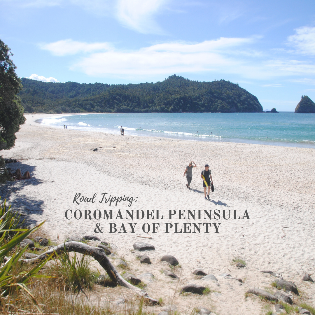
New Chums Beach is a gorgeous golden sand bay. The 15-20-minute hike into the beach travels from the parking lot, across the nearby bay, before cutting across the forested headland and dropping down onto the beach that is fringed with glorious pohutukawa trees. We had a swim in the icy water and then a little bit of time to relax under the pohutukawa trees before heading back to the car to head south in the hope of catching the very end of the low tide window at Hot Water Beach.

Upon getting back to the car, all our best laid plans went to s*** when we found we had a flat tire! After finally getting back on the road, we had a reasonably long drive, and arrived into Hot Water Beach in the dark, hours after low tide, so all we could manage was to head straight to our campground, and set up in the dark. Being quite remote there on the coast, there wasn’t a lot of ambient light, and the night sky was spectacular that evening – I need to learn to take night sky photos!
Day 3 - Hot Water Beach to Mount Maunganui
After a nice warm shower and quick breakfast, we packed up the tent and headed out for the day. The low tide at Hot Water Beach had been at 3am, so we had missed that again. I’ve convinced myself that it would have just been a muddy pool of hot water, and I probably wouldn’t have enjoyed it anyway. Going to keep telling myself that so I’m not disappointed if I don’t make it back there!
Hitting the road on day three, we headed out to the Gateway Trailfor access to Cathedral Cove. This is analternative to the main DOC trail to the cove. The (fee based) trailhead starts on farmland, crossing between rollinggreen paddocks, complete with cows, before ascending a small hill, andeventually meeting up with the paved DOC trail down to Cathedral Cove.

Cathedral Cove was all that I imagined – we dropped down ontothe golden sands of Mare’s Leg Cove, where we looked left immediately into CathedralCove. The iconic archway that you’veprobably all seen in the photos was as spectacular as I’d expected, and I’m justgoing to let the pictures do the talking. It was a gorgeous sunny day, with a light breeze blowing, and the tidewas in, so that it wasn’t possible to walk right through the archway to theother beach (that was a good thing – less people in our photos!). There was a lot of activity on the beach andthe water – scenic boat trips cruising by, kayakers negotiating the swellscoming into shore, and plenty of visitors just stopping for some beach time whilethey were there. Having said that, it wasn’ttoo busy, and if you wanted to hang out on the beach, you’d still have space to yourself – in fact,if you really wanted the remote experience, you could always head through thearchway at low tide, and strand yourself on the other beach until the tide wentdown again!


We had well and truly missed the tides for Hot Water Beach, sofrom Hahei, we just headed straight down the coast towards our next overnight stopin Mount Maunganui. We tootled along at80k’s on our temporary tire, making the most of the scenery and a few littlestops along the way. Lunch was in KatiKati, which turns out to be known for its murals. Weenjoyed a little stroll along the main street checking out the murals before grabbinga pie for a lunch and getting back on the road.

We had a late afternoon arrival into Mount Maunganui, and after finding some parking along the busy Marine Parade, we set out to walk the base of the mountain (there were too many steps to the summit for our liking!!). The base trail around Mount Maunganui is quite wide and well-established and was the perfect easy walk for our tired legs. The views from the base trail out to the Pacific, as well as around into the Tauranga Harbor were awesome, so we didn't feel like we missed out on much. Any other time, I’d definitely head up to the summit, but for this day, the base trail was the right decision.


After circumnavigating the mountain, we headed towards town, indulged in an ice cream as a treat and then wandered down the main street to check out some of the murals that were tucked away on the side streets around town.


Before heading back to camp, we made our way to the beach so that Nina could have a swim. I’d had my one cold water swim for the weekend so instead, sat on the beach watching the surf patrol guys doing some training and just enjoying the tranquility as the sun set over the mountain for the evening.


Day 4 - Mount Maunganui to Auckland (via Waitomo)
Up early on our final day, we packed up camp to hit the roadso that we could make a couple of planned stops along the way before checkingin for our Black Water Rafting tour in Waitomo that afternoon. We’d read about a somewhat hidden waterfalljust outside of Tauranga that was closed to the public (but was supposedlystill accessible by the original trail so long as you just ignored the signage),and decided to risk it and see what we could find. The trailhead remained successfully hiddenfrom us, so we called off our search and made a quick stop at the nearbyMcLaren Falls before hitting the road again and heading towards the PutaruruBlue Springs.

At the Blue Springs, we took a break from driving andwandered down the trail to the spring, for a stroll along the waterline thatoffers some of the cleanest water in New Zealand (it supplies about 60% of NewZealand’s bottled water). There’s two options here – a short 15-20minute walk along the springs, or a the longer Te Waihou Walkway – I think you canprobably see all you need to on the shorter walk, accessible from Leslie Road,but the entire walkway would likely take you further from the crowds, whichwould be nice! All depends on how muchtime you have.


The clarity of the water was amazing, but I wasn’t overwhelmedby the location – perhaps my expectations were just off. Onwards, we continued – making a stop inArapuni to walk to onto the suspension bridge overlooking the hydro station andhave a little natter to the horses grazing nearby. After a tasty lunch at the Rhubarb Café in Arapuni,we hit the road again for Waitomo.


At the Black Water Rafting base, we suited up into the ever-attractivewetsuits, and headed off underground. The Black Labyrinth tour takes the small group through the Ruakuri Cave,walking and wading through ankle to knee deep water through the narrow walls ofthe cave before launching off an underground waterfall (optional – no surprisethat I didn’t do this), and then floating on the tubes beneath a galaxy of glowworms!

The guides form the group into a convoy and paddle you beneath some of the caverns so that you can lay back and enjoy the views of the glowworms above. Towards the end of the cave, we switched off our headlights and paddled through the dark passage towards a speck of light at the exit of the cave. This was a great soft adventure - suitable for just about anyone – the guides made everyone feel comfortable, and the cave didn’t feel claustrophobic (to me) at any time. If you’re a little more- intrepid than me, then there’s the Black Abyss tour which includes rappelling through the cave as well.
From Waitomo we had a straight 3-hour drive back intoAuckland and somehow managed to miss most of the afternoon traffic which was a happyway to end a great trip.


Map It!


Of course there was way more on our bucket list for this trip than we managed to achieve just due to the time factor, but I would definitely like to get back down to the area to check out the Hot Water Beach, do some more walks around the Coromandel Peninsula and the Karangahake Gorge area.
I'd also like to spend some more time around Mount Maunganui and Tauranga to walk to the peak of the mountain and check out all the street art in those two towns. If you're road tripping around the North Island, and have even more time, then you could definitely detour via Rotorua to take in some of the cultural and geothermal activities on offer (there's plenty of them!). I was just in Rotorua on a quick weekend getaway, so visit my post on what there is to see and do in Rotorua in a weekend.
